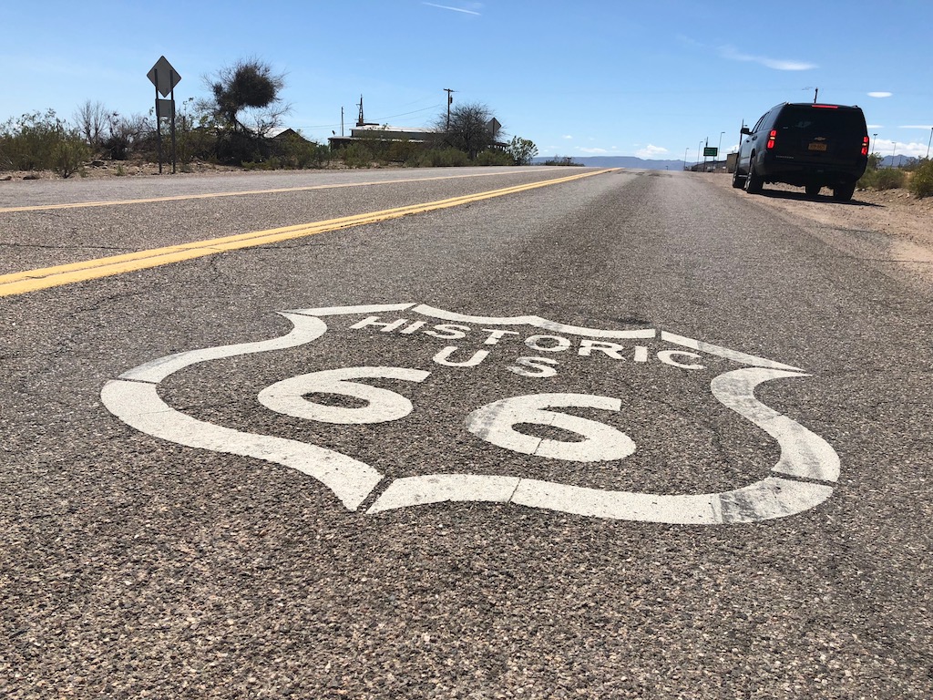
It was time to start Route 66, we’ve incorporated The Mother Road into our westbound journey from coast to coast as much as possible. We are diverting off to take in Nashville & Memphis, so we definitely won’t be covering the section from St. Louis to Oaklahoma City.
If you’ve just joined our adventures, we’re driving a Chevrolet Suburban for a month on a road trip in the USA, there are 4 of us, so we wanted something comfortable and big enough to handle our luggage.
Day 1: Chicago (Illinois) to St. Louis (Illinois) – 333 miles – 10.5 hours
We headed out of Chicago at 8am, the traffic was quite heavy but not too bad getting out of the city. We are using the EZ66 Guide 4th Edition by Jerry McClanahan and the EZ66 App for navigation along the route.
We picked up Route 66 at Ogden Ave in Cicero, around 8km from our hotel in Chicago. The road isn’t in great condition on this section, it’s a rough surface and speed limits of 20-30 mph with potholes, not a bother for us in the Suburban but might be troublesome for bikers and sports cars.
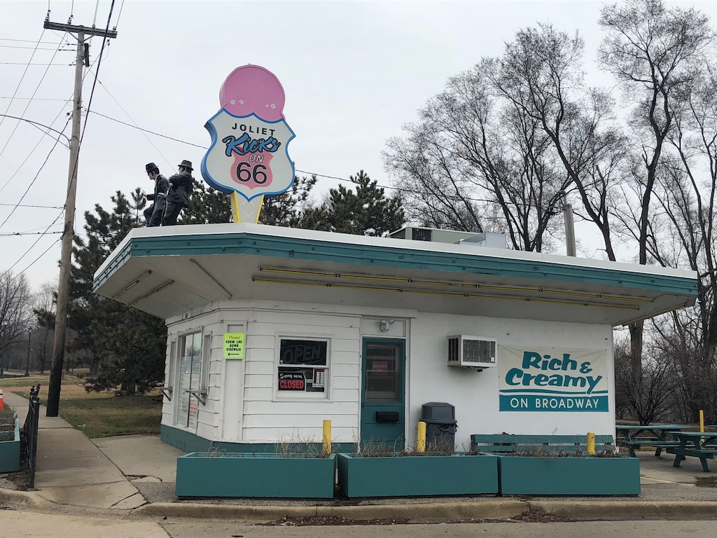
We were an hour into the journey with limited signage, when we picked up our first Route 66 attractions. We pulled into the “Kicks on 66” park in Joliet to photograph the Blues Brothers dancing on top of the Rich and Creamy. Plus, Dicks with “California or Bust” on the opposite side of the road.
The signage was excellent through Joliet, the brown Route 66 signs were matching our instructions from the EZ66 Guide. We were looking for somewhere to stop for breakfast, and pulled into Pops. The countryside was opening up and the speed limit had increased to 55 mph so we were making some progress.
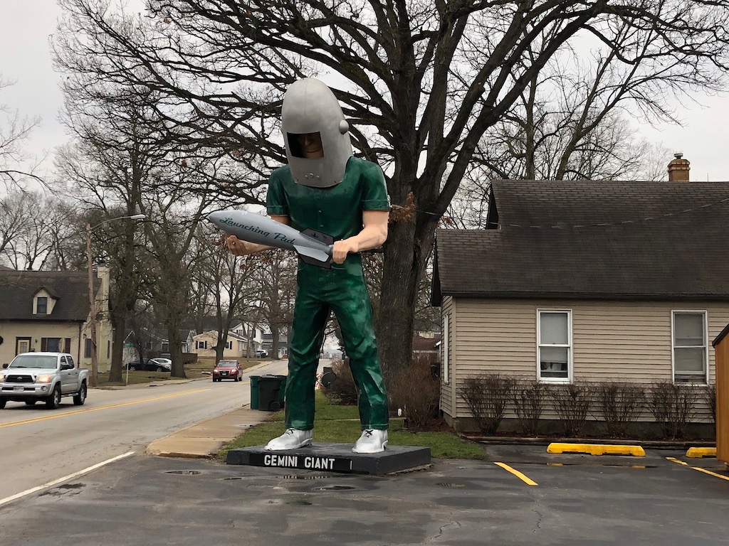
We spotted our first “Muffler Man” at Wilmington, the Gemini Giant is considered to be one of the best examples of these huge figures. Our guide said the Launching Pad Drive in was closed, however there was a shop open at this site when we passed through.
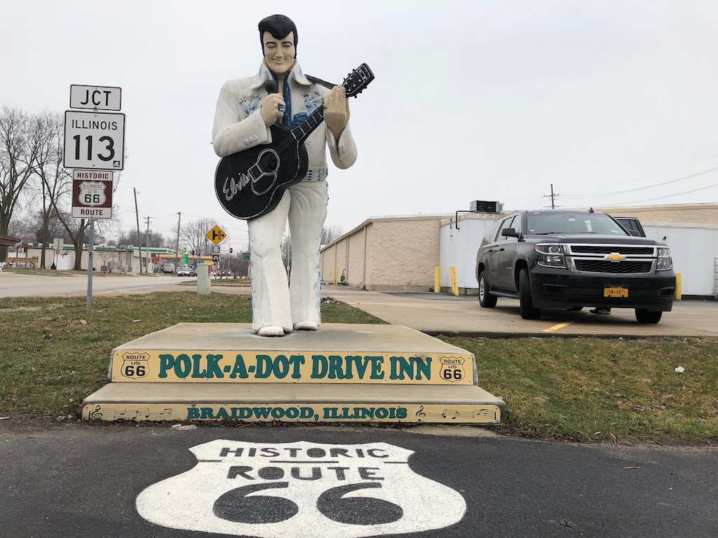
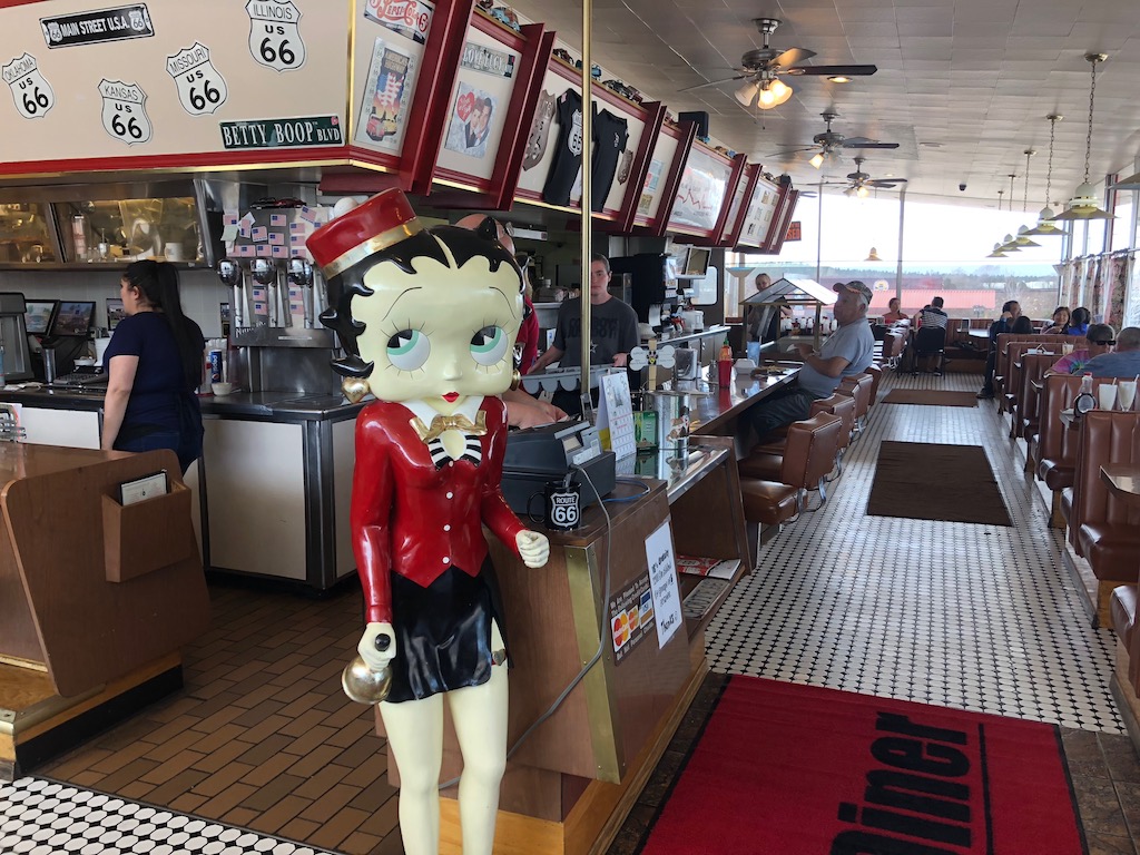
We should have waited and had our breakfast at the Polka Dot Drive In at Braidwood, this 50´s style diner was fabulous. There are Elvis, Marilyn Monroe, James Dean, Betty Boo & the Blues Brothers figurines outside, and a classic American diner interior complete with juke box inside. There were a few cars queueing in the drive thru. If you are thinking of eating here, it was approx 2.5 hours drive from Chicago.
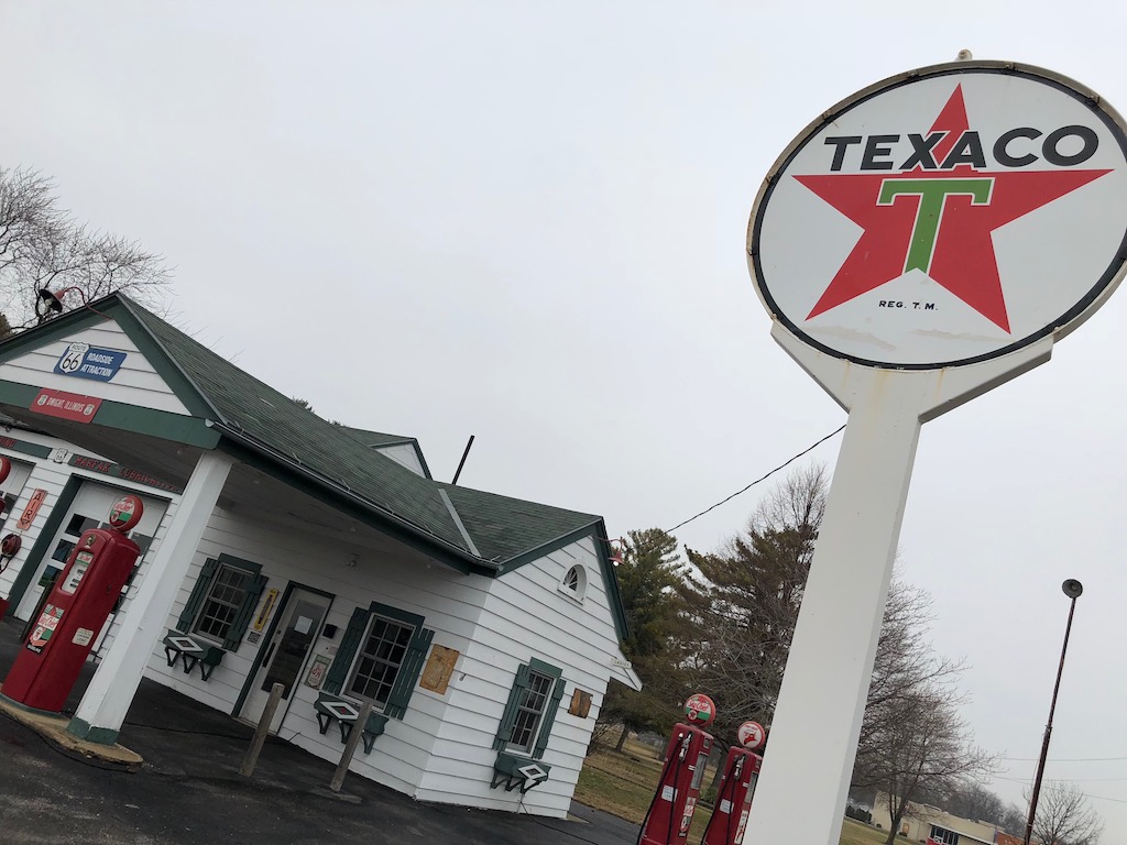
We were blown away with the beautifully restored Ambler’s Texaco garage in Dwight. We’re travelling outside of season, so it was closed, but we still had a good nosey around. This building is on the National Register of Historic Places. Across the junction was the Old Route 66 Family Restaurant.
We stopped at the Octane 66 garage on our way into Pontiac, there’s lots of old cars parked up on the forecourt here. You must stop in Pontiac at the Route 66 Hall of Fame Museum, there’s lots to see in this area. The ground floor of the old fire station is dedicated to Route 66, the upstairs is a war museum. Follow the red and blue footprints around the courthouse in the square to find the Pontiac Auto Museum and see the painted murals, I also liked the random multicoloured model cars parked on the pavements.
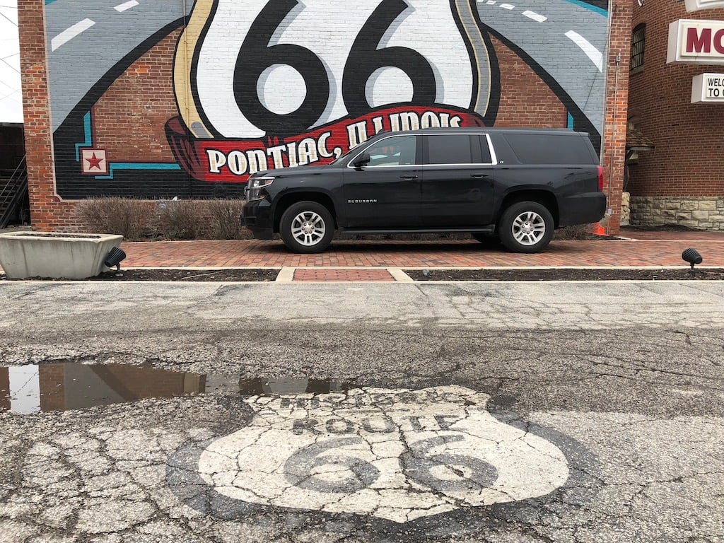
Before you leave, park your car on the brick road in front of the Route 66 mural at the back of the Route 66 Hall of Fame Museum.
The day was slipping away, it was 13:30, we still had around 300 miles to travel via Route 66 to St. Louis. We had booked a bed & breakfast property for our next stop as change from hotels, which meant we had to check in at our overnight stop between 16:00 – 18:30.
We had to make a compromise so a decision was made to get on the I-55 to Springfield allowing us to get some speed up for 100 miles, then rejoin Route 66 at the Lauterbach Giant.

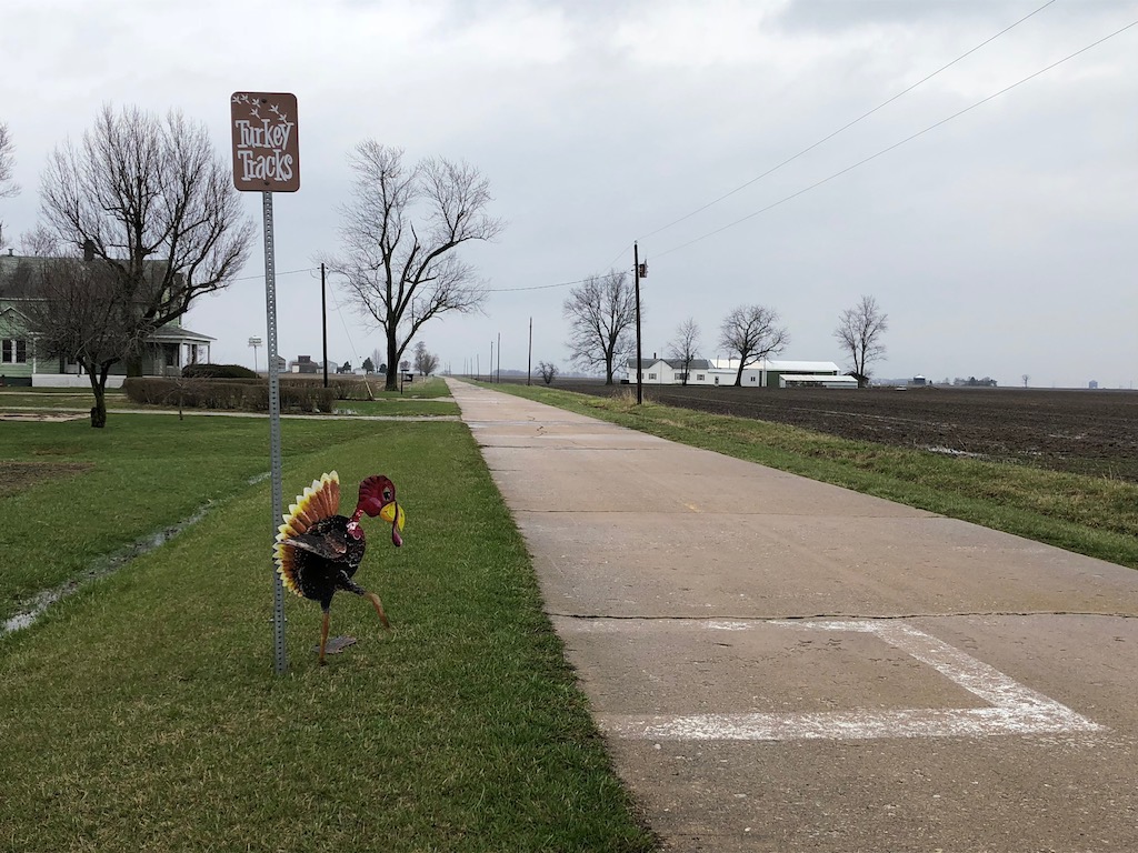
After finding the giant we followed Route 66 to drive the 1.4 mile section of brick road between Chatham and Auburn, and on to Nilwood to see the Turkey Tracks in the 1920’s concrete road.
It was getting warmer, the temperature was 52-54 degrees °F and no sign of any snow, although talking to the locals, they had 8 inches of snowfall recently.
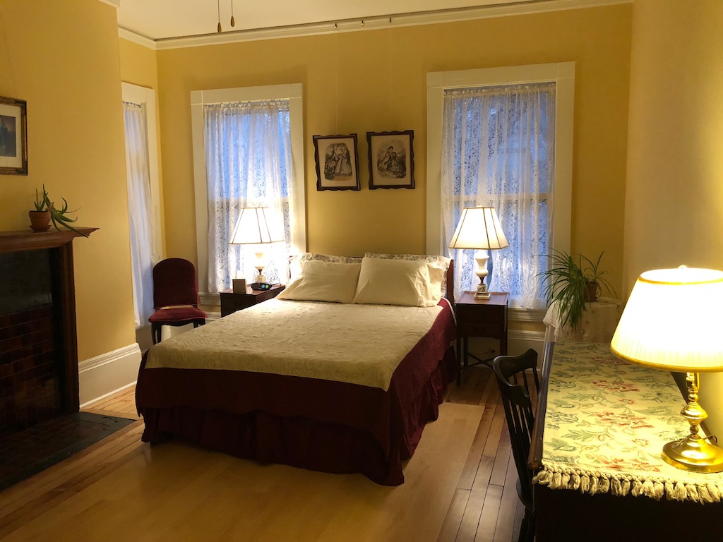
We hit traffic 30 miles out from our destination, so we started to have a look in more detail about where we were staying and discovered it was on the list of the most haunted hotels in the United States! The Lehmann House is supposed to be haunted by it’s first owner Edward Rowse who built the 22 room property in 1893.
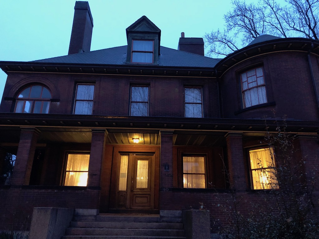
We met our host Marie who gave us a tour of the house, including the famed master bedroom, and showed us to our rooms for the evening. We were next door to the ghostly goings on, and our friends were directly opposite, this was going to be an interesting experience.

Food was on our mind, we were recommended to visit the Square One Brewery & Distillery just a short walk away and it was excellent. The property is a beautifully restored historic building on the National Register of Historic Places in Lafayette Square, St. Louis
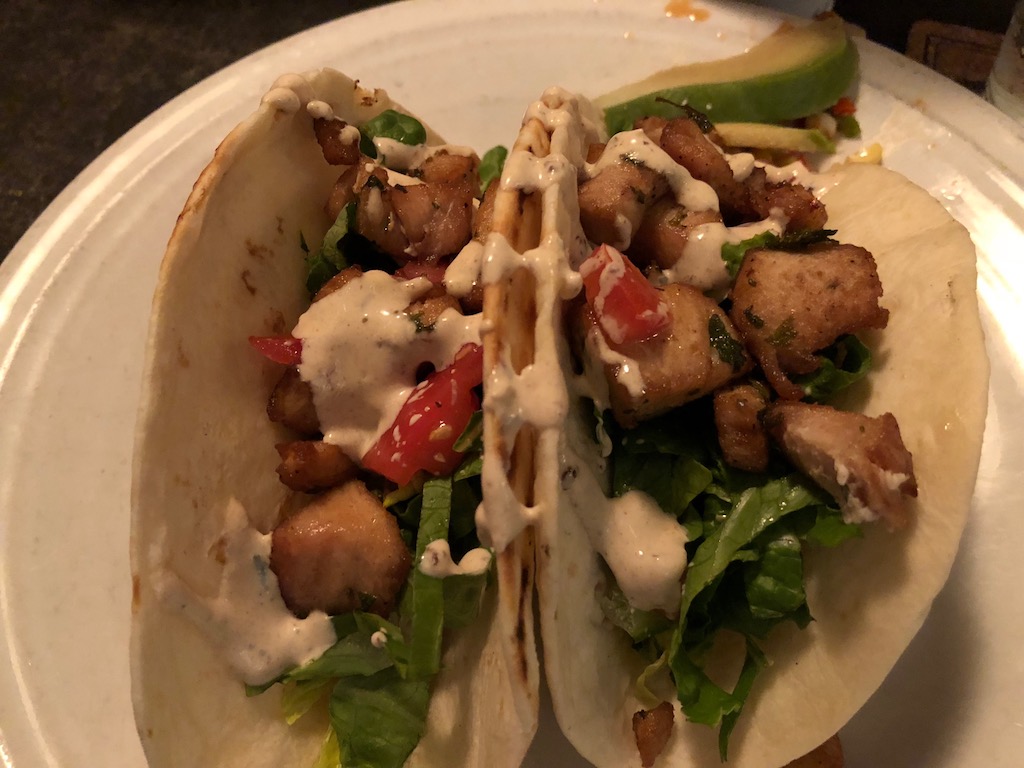
We tried their Maple Stout which hit the spot after a long day driving, 5% in alcohol with a maple flavour finish. There were some really interesting options on the menu, where they combine their master brewing skills with local produce. I ordered the Mahi Mahi Tacos, this is a local fish marinated in chipotle and Agave Blue American Tequila with smoked tomatoes, avocado, chipotle sour cream and grilled corn salsa. Mike went for the Crab Cake Sliders, which is house-made crab cakes with mixed greens & tomatoes, topped with lemon pepper aioli. Conveniently both dishes came in a quantity of 2 on each plate, so we could easily share.
It was time for bed, were we going to experience any ghostly experiences? Well apart from a strange incident with a bedside light, there’s nothing else to report this morning.
We’re looking forward to our 4 course cooked breakfast downstairs, before we divert off Route 66 for a night at the Grand Ole Opry in Nashville and a visit to Graceland in Memphis over the Easter weekend.
Day 2: St. Louis (Illinois) to Nashville (Tennessee) diversion off Route 66 – 357 miles & 7.5 hours journey
Day 3: Nashville (Tennessee) to Memphis (Tennessee) diversion off Route 66 – 245 miles & 4 hours journey
Day 4: Memphis (Tennessee) to Oklahoma City (Oklahoma) to get us back on Route 66 – 474 miles 9.5 hours
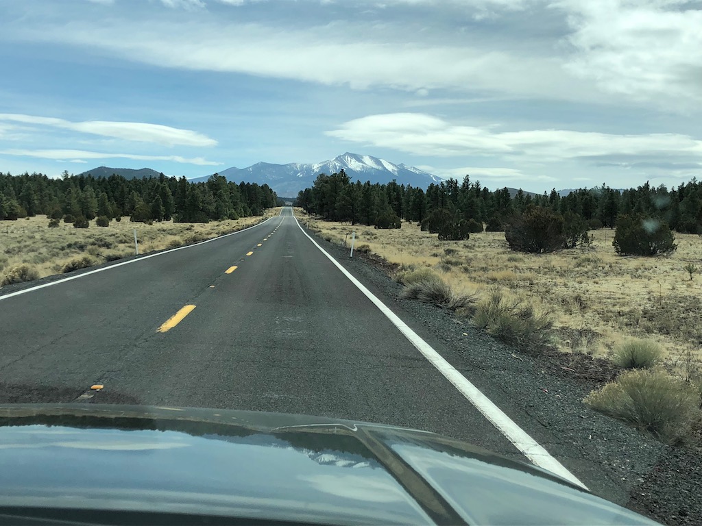
Day 5: Oklahoma City (Oklahoma) to Amarillo (Texas) – 296 miles – 6 hours journey
We rejoined Route 66 at Fort Reno and enjoyed a fantastic drive on the 1930’s section of the road from El Reno to Hydro, a rolling road with long straights passing farms with cute tractor post boxes. We crossed the Pony Bridge which is 3/4 of a mile long, you can see how much water passes through this region from the deeply gouged out river banks.

The I-40 W pretty much runs alongside Route 66 for the duration of this section, we kept on the old road to see Lucille Harmon’s house and the F-4C Phantom II jet that marks the entrance to the Thomas P Stafford Air & Space Museum. We bypassed Clinton and drove through Canute & Elk City to see the remnants of Route 66 including Timber Creek Bridge.
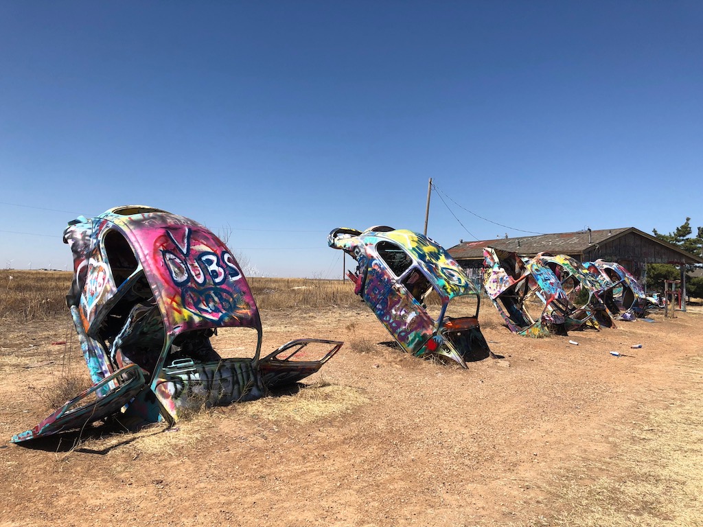
We took a break back on the I-40 W until Groom where we rejoined Route 66 for The Leaning Water Tower and Bug Ranch at Conway – which I loved having owned a couple of VW beetles. We watched in amazement as the temperature climbed from 46 °F to 82 °F over the duration of 1 hour 20 minutes!
Our friends had booked a gun range for our overnight stop in Amarillo, Texas. It was interesting to hear a pro gun opinion on gun laws, after being in Washington D.C. for the March For Our Lives protest against gun violence. We were able to understand the arguments from both sides regarding the gun issues in the United States.
We’re staying at the Sleep Inn & Suites just off the I-40 in Amarillo, their king rooms include a microwave and fridge, the hotel also has a small pool and gym.
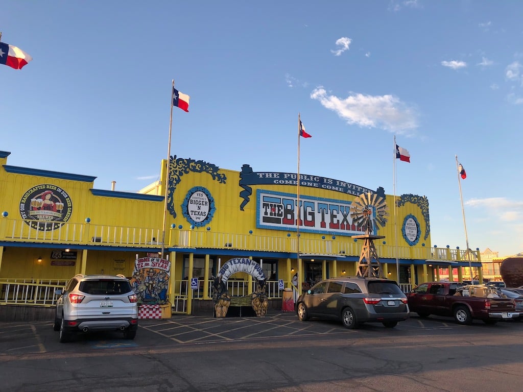
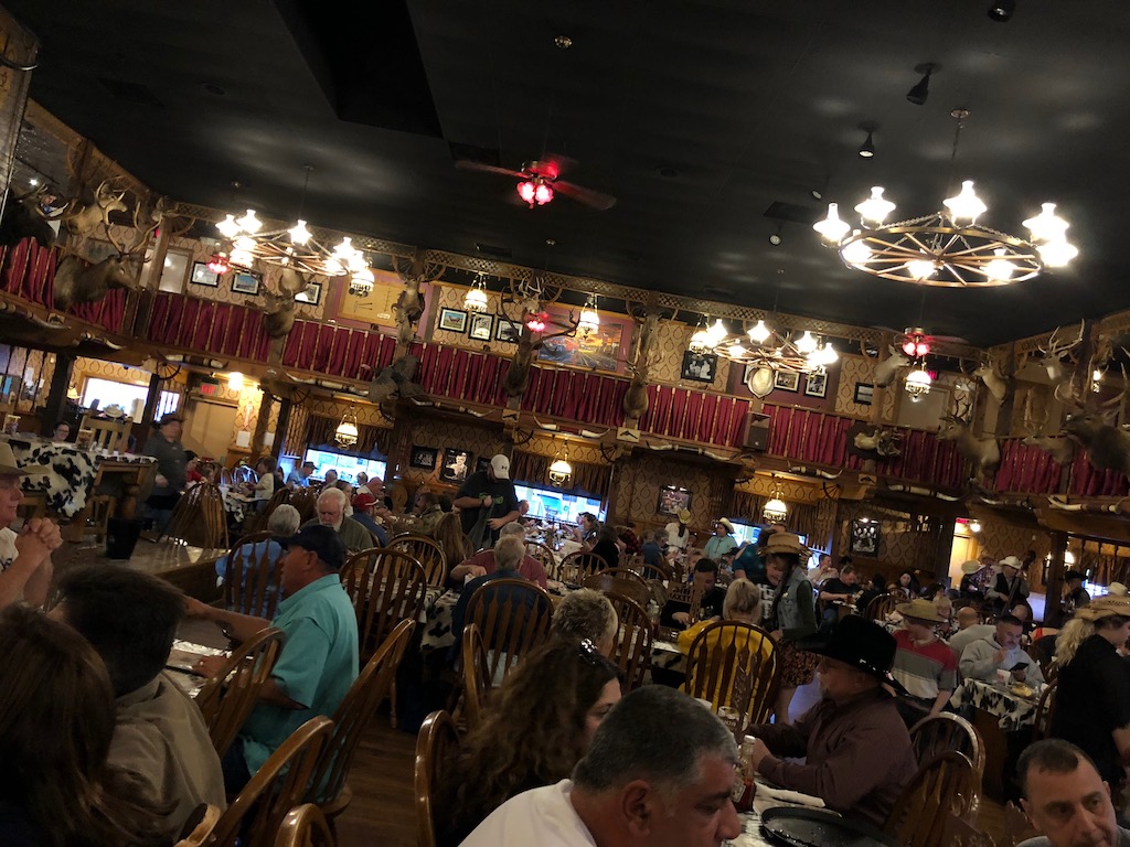
We dined at the Big Texan Steak Ranch, they have billboards across 7 states attracting travellers passing through Amarillo. It’s a bit cheesy, but they offer a great service including a free cadillac limo service from local hotels.
We’d had a local tip to go to Silvergrass for the best steak in town, if you want to avoid the tourist crowd.
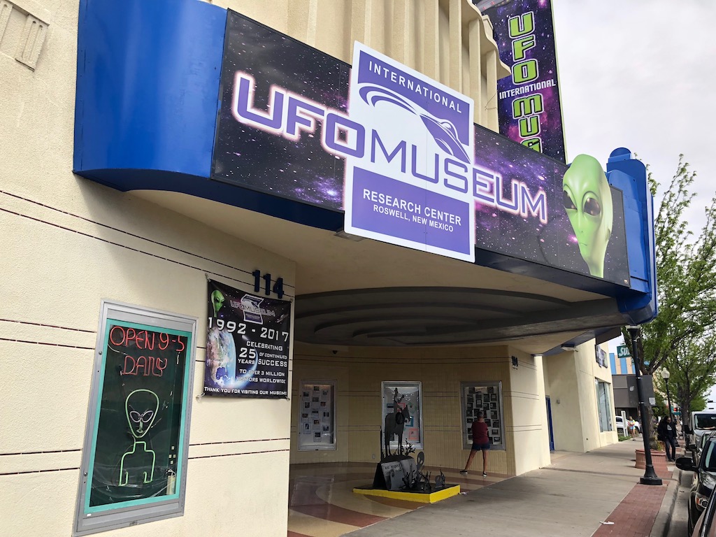
Day 6: Amarillo to Albuquerque (New Mexico) another diversion off Route 66 to visit Roswell – 211 miles – 3.5 hours & 199 miles – 3 hours
Our friends were very interested in visiting the Roswell UFO museum, so we skipped Route 66 for this section and drove the US-60 W which is a long, straight and flat road to Roswell, where we visited the museum and had lunch (we gained an hour with the time zone change).
The drive from Roswell to Albuquerque was long and straight but climbed steadily to reach the mountains in the distance. We saw trains pulling 100+ carriages of freight along the side of both of these roads. We had rejoined the I-40 W at Clines Corners, we’d driven a few miles when to our delight we spotted a cowboy on horseback with a herd of cattle. We enjoyed the change of scenery through the Cibola National Forest, before descending into Albuquerque for an overnight stop.
Day 7: Albuquerque to Winslow (Arizona) via Acoma Pueblo & the Petrified Forrest – 324 miles – 8.5 hours
Wow! We were blown away by the scenery on this leg of Route 66.
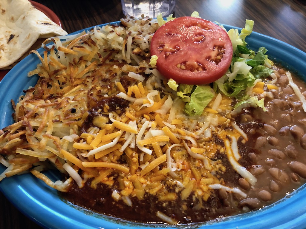
We went to Mannie’s Diner for breakfast in Albuquerque, which dates back to 1965. I wasn’t sure about having chilli at this time of the day, but I had to try their Huevos Rancheros. This dish is tortilla (option plain or corn), 2 eggs (fried or scrambled), hash brown, beans and chile (red or green and with or without meat). The chile can be separate to pour over or just poured on top. I went for everything and have to say it was really tasty and I didn’t need anything to eat until the evening.
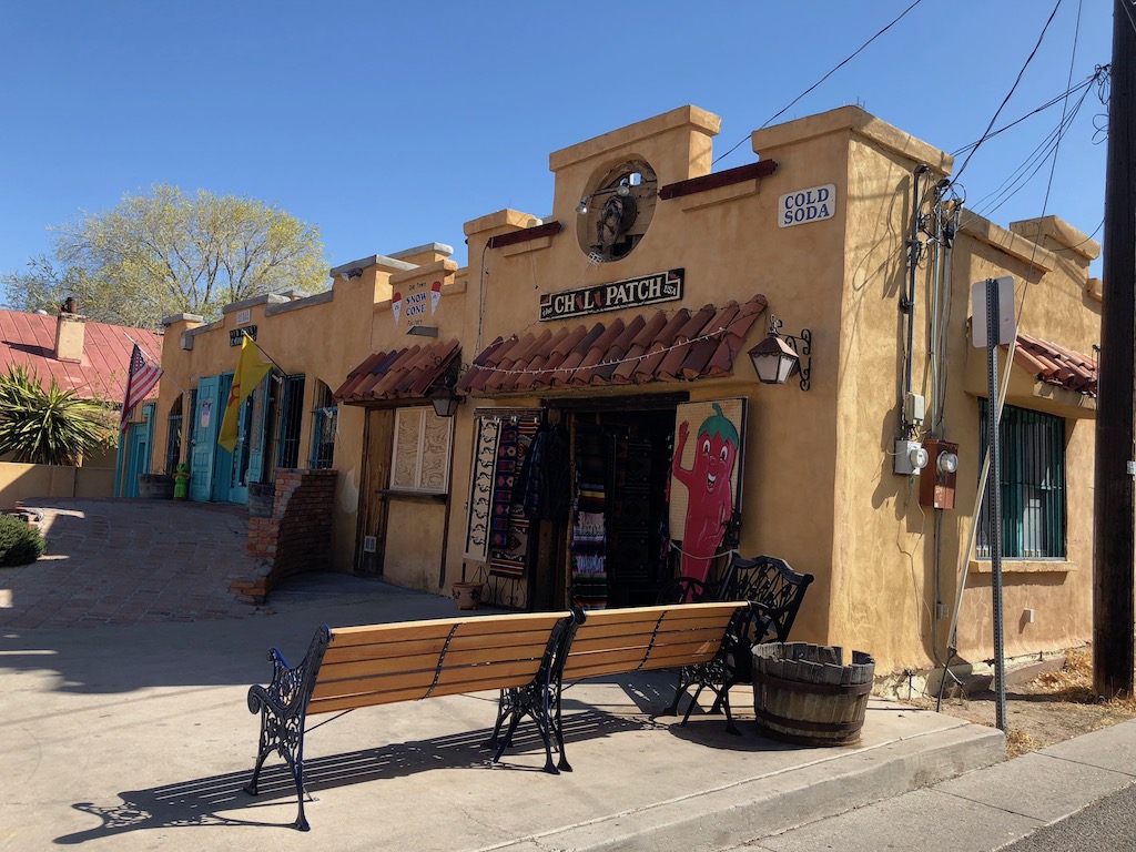
The next stop was the old town plaza in Albuquerque which is gorgeous. We really enjoyed a walk round the square, browsing the shops. I enjoyed chatting with Bob, a volunteer in the information centre, who was really helpful and gave me some Route 66 literature for New Mexico.
We took the I-40 W out of town to visit Acoma Pueblo, and the Petrified Forest along the way to Winslow. The drive was visually great from the start, with the red rock cliffs around Mesita. We didn’t take the guided tour of the ancient Acoma Pueblo, we made do with a short stop at their visitor centre.

We rejoined Route 66 at El Malpais where the countryside had crusts of black lava, which reminded us of Lanzarote, as well as the name. We gained an hour on route from New Mexico to Arizona and reached an elevation of 6000 feet at Fort Courage in Houck.
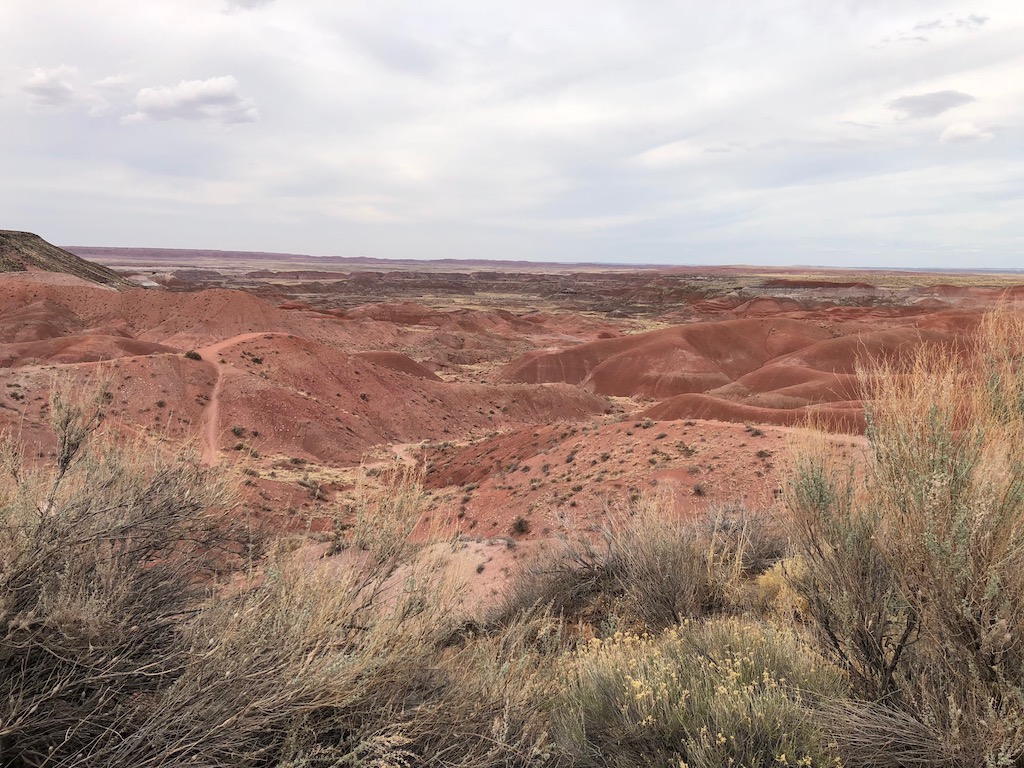
You have to visit the Petrified Forest National Park in Arizona if you get the chance, it’s stunning, non of us had realised just how special this place was. The car entry fee was the best $20 we’ve ever spent.
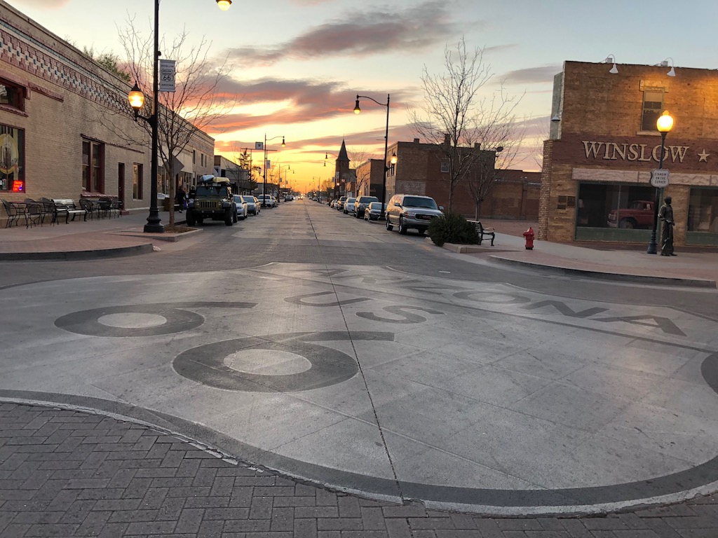
We arrived at our hotel as dusk was falling, so we checked in quickly and headed out to find Standin’ on the Corner Park and get something to eat. This spot in Winslow is a fabulous area for Route 66, with a collection of cafés and gift shops. There is a red Flat Bed Ford parked up at the side of the corner commemorating the song “Take It Easy” which was recorded by the Eagles.
Day 8: Winslow (Arizona) to Grand Canyon Village via Meteor Crater -156 miles – 5.5 hours
We only had a short drive for this journey, Meteor Crater was just 30 minutes from our hotel in Winslow.

2.5 hours of the time was spent exploring Meteor Crater, as we waited to take a 1 hour tour along the rim of the crater, as well as watching a short film and visiting the museum. Meteor Crater is the breath-taking result of a collision between an asteroid traveling 26,000 miles per hour and planet Earth approximately 50,000 years ago. It is nearly one mile across, 2.4 miles in circumference and more than 550 feet deep.
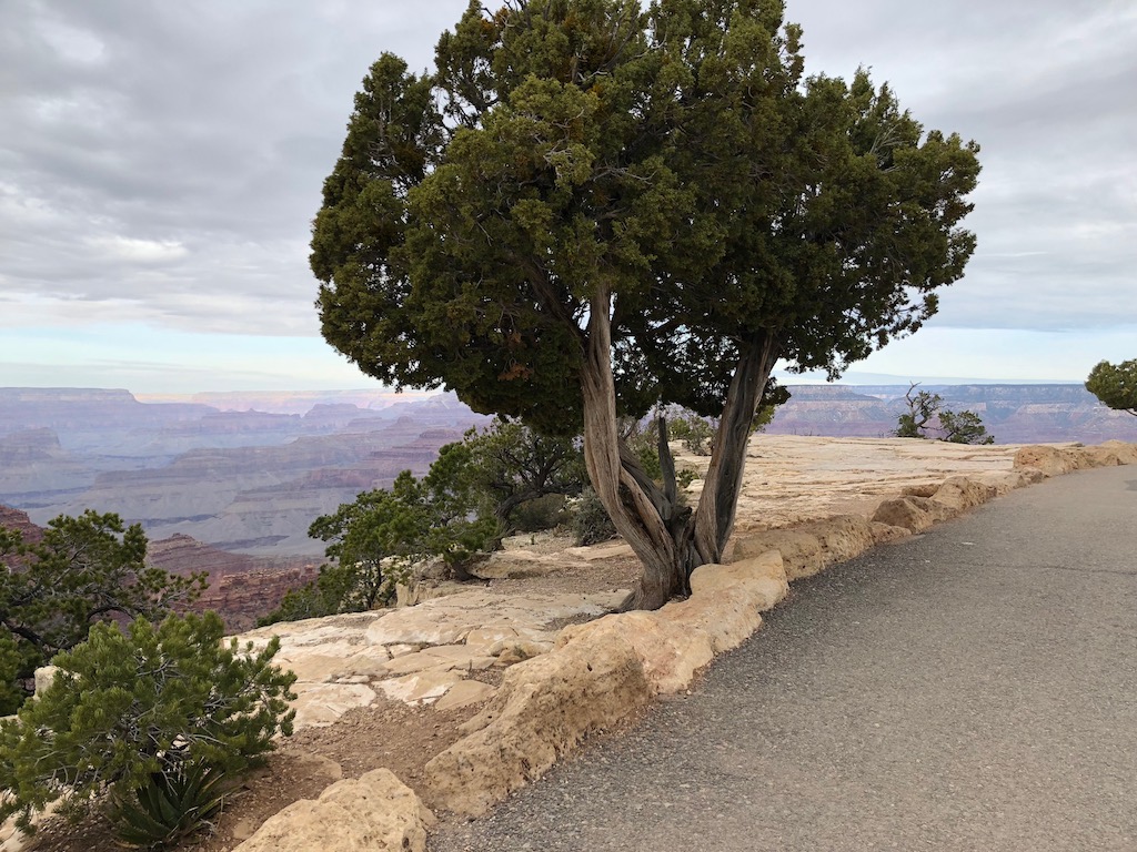
We rejoined the I-40 W driving through the Coconino National Forest, exiting at Williams for a milkshake at Goldie’s diner on Route 66. An hour later we had driven the 50 miles along the AZ-54 to Grand Canyon Village where we were staying at the Best Western Premier Grand Canyon Squire Inn. We were too early to check into our hotel room, so we left our luggage with reception and entered the Grand Canyon National Park to self drive up to Desert View and work our way back towards the Visitor Center. A private vehicle pass for 1-7 days is $30.
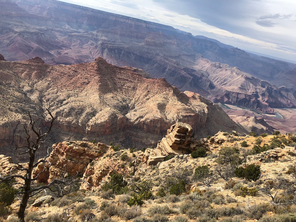
We visited the West Rim in November 2016 during a trip to Las Vegas, the South Rim is much more impressive, and I especially liked the freedom of exploring at your leisure.
Day 9: Grand Canyon Village (Arizona) to Sedona (Arizona) -110 miles – 3.5 hours
After an early breakfast we walked 5km along the Rim Trail at the Grand Canyon, it was lovely almost having the place to ourself and saw lots of wildlife as well as epic views.
Although much warmer, there’s still a big difference in temperatures, we started at 47 °F in the morning and it was a high of 82 °F by the afternoon.
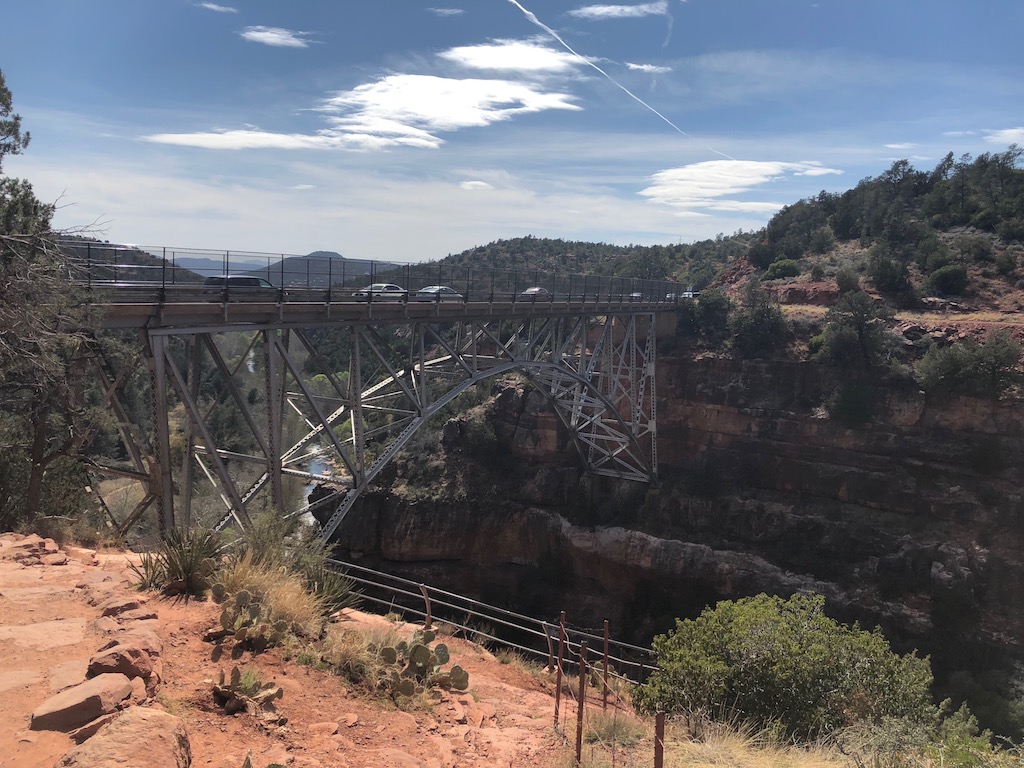
We took the scenic routes to Sedona, travelling along the I-80 San Francisco Peaks Scenic Route through the Coconino National Park which is forested. Stopping in Flagstaff for a coffee, before driving the epic highway 89A through Oak Creek Canyon, a stunning road for passengers and driver.

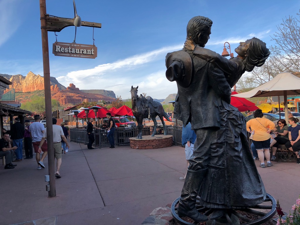
Sedona is marketed as the most beautiful place on earth, I’m not sure I agree with that, but it is stunning. Used as a Hollywood film location in the golden era, Sedona now attracts 3 million visitors a year. Most of the town was developed from 1988 it definitely feels like you’re in a tourist resort.
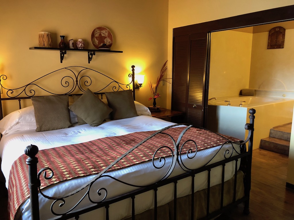
Our accommodation is in a rural location on the outskirts of town, called Sedona Views Bed & Breakfast, we even have a private jacuzzi on our terrace with fabulous views of Cathedral Rock.
After a walk around town we ate at Sedona Pizza & Pasta, their Arugula & Apple salad and Buttero pizza was delicious.
Afterwards we watched the night sky from the jacuzzi with a bottle of California fizz produced using the champagne method and saw a shooting star!
Day 10: Sedona (Arizona) to Palm Springs (California) – 497 miles – 11 hours
Breakfast was served at 8.30, so we didn’t start our long journey until an hour later, but it was worth waiting for and set us up for the day.
Instead of back tracking up to Flagstaff and Williams, we left Sedona via the 89A South and climbed up to reach the historic copper mining town of Jerome, once known as the wickedest town in the west. We reached a height of 7000 ft in Prescott National Park before descending the other side through the valley to reach Seligman where we rejoined Route 66.
We really enjoyed driving this section of Route 66 from Seligman through Peach Springs, Truxton, Hackberry there’s so many Route 66 places to see along the way. The temperature was 87°F in Kingman.
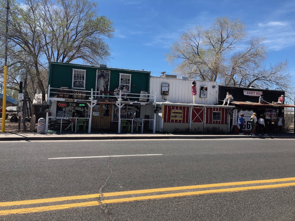
We followed Route 66 on Highway 10 across the sandy Sacramento Wash and the twisty mountain pass to Oatman. This place was established as a gold mining town in the Black Mountains of Mohave Country after 2 prospectors struck a $10 million gold find in 1915.
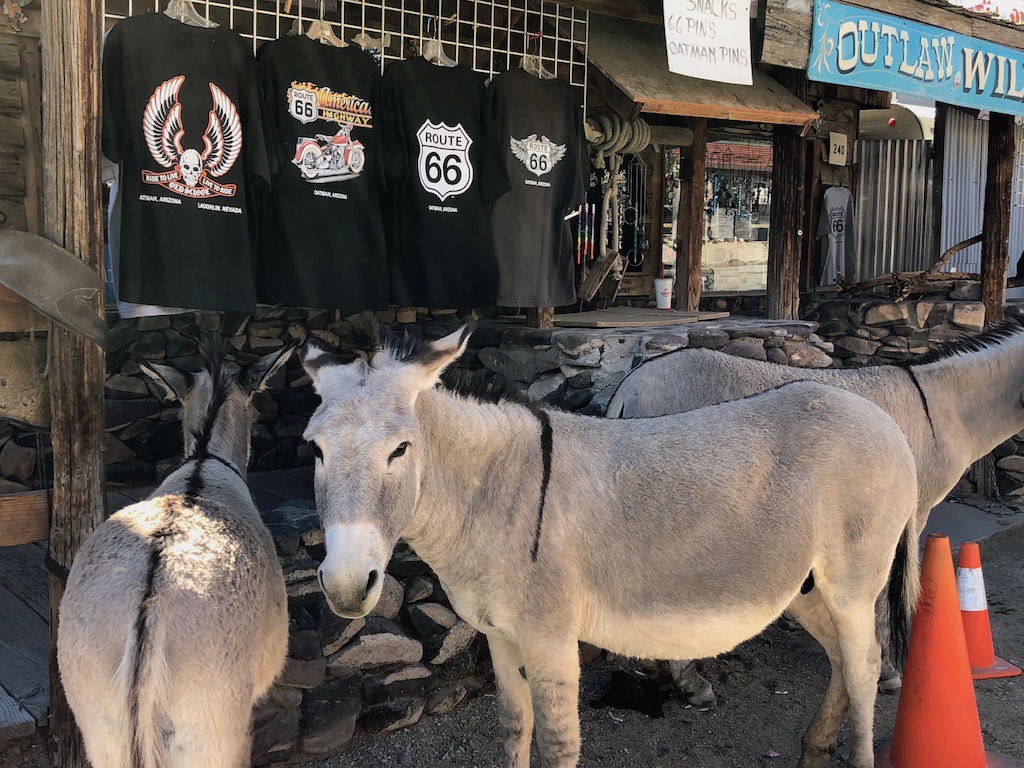
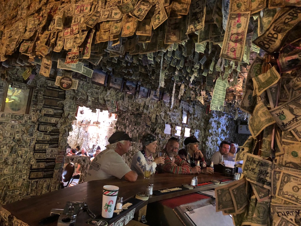
Today this quirky town with it’s wild burros is a tourist attraction, we’d missed the gun fight at 1.30pm so wandered the street, feeding the burros and browsing the shops. We stopped by the Oatman Hotel for a milkshake, the saloon walls are covered in 1 dollar bills that are dated and signed – this tradition started with the gold miners who used to search for their dollar bill on the wall, when they were short of cash to pay for their drinks.
We were now leaving Route 66 to start the last section of our road trip exploring California, although we will of course go and find the official finish of the Mother Road at Santa Monica in Los Angeles in a few days.
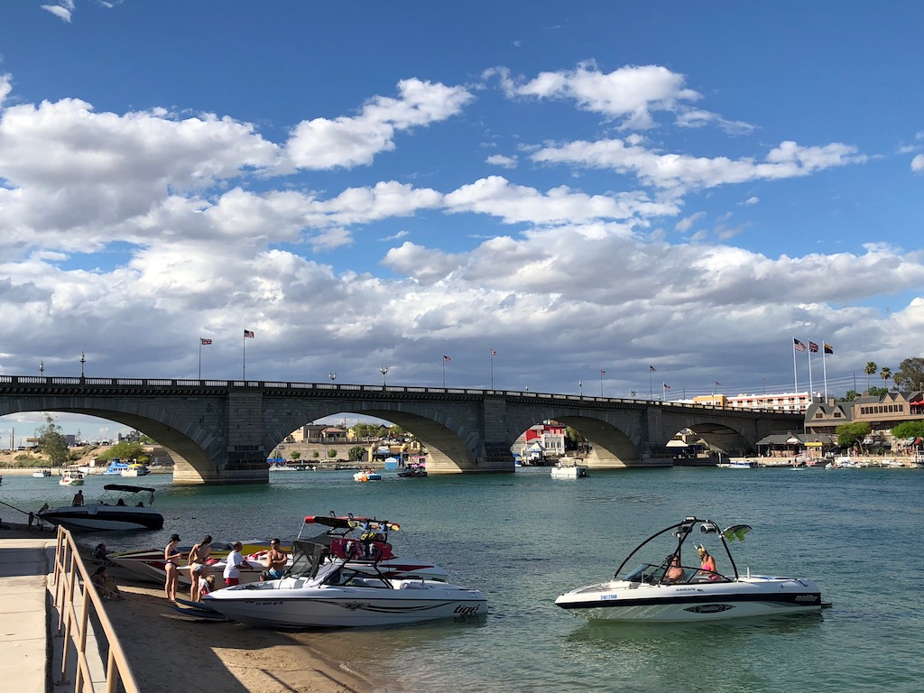
We stopped at Lake Havasu to see London Bridge! The City of London auctioned the original London Bridge in 1968, the winning bid was entrepreneur Robert P. McCulloch at the price of $2,460,000. The bridge was meticulously dismantled and shipped to California linking the island with Lake Havasu City becoming an Arizona attraction and a place where the boating crowd like to hang out.
The temperature reached 102°F in the afternoon, we followed the AZ95 along the Colorado River, then picked up the High Desert Highway 62, the deadliest road in California!
Route 66 West End Finish: Santa Monica, Los Angeles (California)
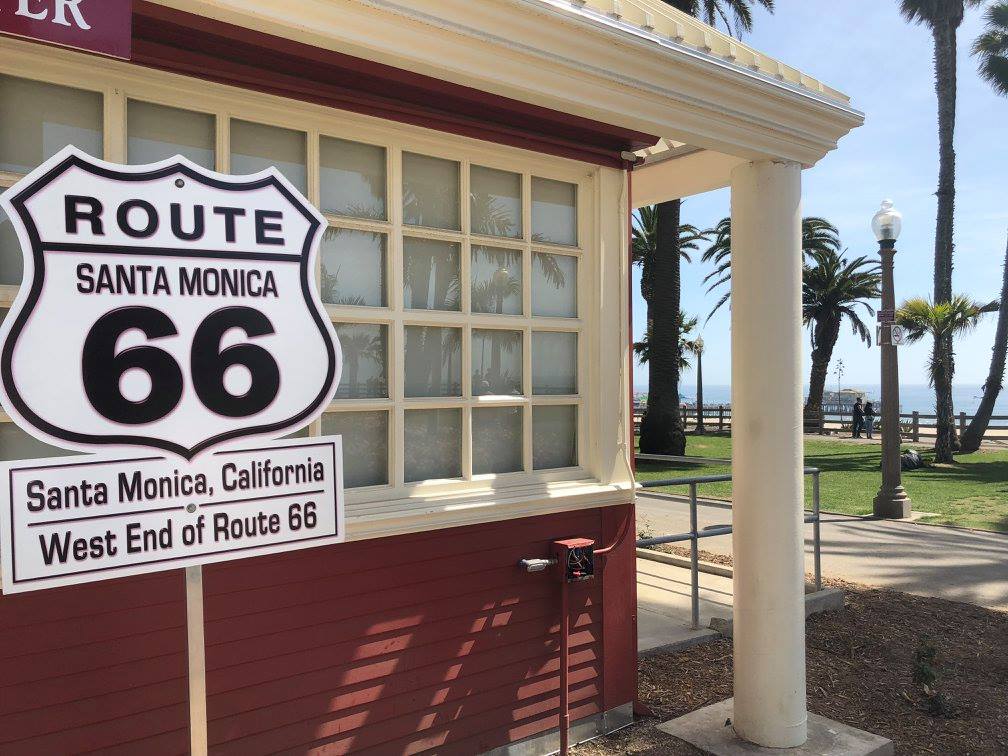
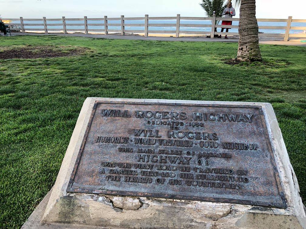
After stops in Palm Springs and San Diego, we reached Santa Monica to find the end of Route 66. We found 3 places:
Tourist Information centre on Ocean Drive (note the sign is only there during open hours)
End of the trail marker on Santa Monica Pier (this was established in 2009 as a more fitting place to mark the end of the Mother Road)

Will Rogers Memorial Plaque in Palisades Park (Route 66 was the first road he travelled in a career that led him straight to the hearts of his countrymen)
For us Santa Monica wasn’t the end of the road, so far we had covered 4998 miles on our trip and we still had the Pacific Coast Highway to drive from Los Angeles to San Francisco. You can continue our adventure here: California – Camel Travel On Tour
You can find our photos from this trip on Facebook here: Route 66 Photo Album.
Mike’s Thoughts
The reality of driving Route 66 is that it is no longer a single road, so it can be quite hard to follow in some places.
What you have left is some stretches of the original dirt road, some of the next version, which was paved with bricks, and quite a lot of the asphalt road, which is single carriageway and can be quite twisty. You’ll spend a fair amount of time with your head in a map or the excellent Route 66 app, and even when you’re driving, your average speed will be relatively low, so allow plenty of time.
The new main dual carriageway runs close and often alongside the old Route 66, so if you’re ever struggling for time, it’s easy to jump onto that and get a few miles under your belt at high speed. We did this a few times, having first checked we weren’t going to miss anything interesting.
You need someone on your team who is a good navigator – you couldn’t drive and navigate the route at the same time. In many places, the road is quite rough, so a motorbike or sporty car would be tough going in places – I loved our big, bouncy Suburban, which floated over the bumps.
You’ll see America in a way most tourists never get to see the place, and for that alone, it’s well worth doing. Some of the places on the route have embraced Route 66 and offer fascinating insights into the old “mother road” and her millions of travellers over the years, and some of the diners are simply amazing, offering huge, tasty meals for very little money.
If you’re a petrol head it’s something you should do – I’m chuffed to bits to be able to say I’ve driven the most famous road in the world!
#cameltravelontour
#route66